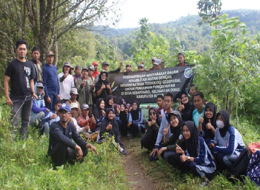
Pendampingan Masyarakat Dalam Rehabilitasi Hutan dengan Memanfaatkan Teknologi Geospasial di Desa Resapombo Kabupaten Blitar
Main Article Content
Abstract
Agriculture is a great potential in Resapombo Village. However, over time the community has not been able to use the land properly so that the land becomes less productive. The land experiences landslides, especially when rain occurs due to the absence of standing plants or trees that become water catchment. There is a need for forest rehabilitation by utilizing geospatial technology. Forest rehabilitation aims to restore forest functions. The methods used in this community service activity are coordination and socialization to the community, plant breeding, planting seedlings, aerial photography, and aerial photo processing, as well as making maps. The result of this community service activity is the Map of the Forest Rehabilitation Planting Area of Resapombo Village-Blitar Regency. The map made can be utilized in effective and efficient forest management and plant monitoring to be optimal. People with high enthusiasm and awareness and concern for the surrounding environment, especially forests, are provisions for the success of forest rehabilitation carried out. The community is expected to be more protective and understand the importance of forests for their survival, especially for the next generation.
Article Details

Jurnal Pemberdayaan Masyarakat is licensed under a Creative Commons Attribution 4.0 International License.
References
BPS Kabupaten Blitar. (2021). Kabupaten Blitar Dalam Angka 2020. Blitar: Badan Pusat Statistik
BPS Kecamatan Doko. (2021). Kecamatan Doko Dalam Angka 2021. Blitar: Badan Pusat Statistik.
Ariga, H., Subhan, S., & Moulana, R. (2022). Persepsi Masyarakat Terhadap Kegiatan Rehabilitasi Hutan dan Lahan (RHL) di Desa Tingkem Kecamatan Blangjerango Kabupaten Gayo Lues. Jurnal Ilmiah Mahasiswa Pertanian, 7(2), 831–835. https://doi.org/10.17969/jimfp.v7i2.20208
Barokah, U., Rahayu, W., & Antriyandarti, E. (2022). Pemanfaatan Lahan Pekarangan dengan Tanaman Bumbu Dapur Berkhasiat untuk Kesehatan di Kecamatan Mojolaban, Kabupaten Sukoharjo. JPM (Jurnal Pemberdayaan Masyarakat), 7(2), 856–862.
C., W. R. M. M. I. T. R. A. U. R. G. R. W. M. M. . A. F. H. . A. S. P. . N. P. P. (2019). Pembuatan Peta Foto Udara Kelurahan Wates. Jurnal Pengabdian Dan Pengembangan Masyarakat, 2(2), 1–7. https://doi.org/10.22146/jp2m.42294
Purwanto, T. H. (2017). Pemanfaatan Foto Udara Format Kecil untuk Ekstraksi Digital Elevation Model dengan Metode Stereoplotting. Majalah Geografi Indonesia, 31(1), 73–89. https://doi.org/10.22146/mgi.24246
Salah, S., Syarat, S., Memperoleh, U., & Sarjana, G. (2015). Peranan kelompok tani dalam peningkatan produksi usahatani semangka di kelurahan bontolebang kecamatan galesong utara kabupaten takalar.Skripsi. Universitas Muhammadiyah Makassar
Hermawan, Yudi, Sri Sulastri, dan Niniek Dyah K. (2016). Keberhasilan kelompok tani dalam program rehabilitasi hutan dan lahan. Jurnal Ilmu Ilmu Kehutanan, 1(76), 61–68.
Mutaqin, D. J., Adriansyah M. N., dan Rahayu N. H. (2021). Penerapan teknologi informasi dan komunikasi dalam bidang kehutanan menuju kehutanan 4.0. Bappenas Working Papers, 4(2), 218–238. https://doi.org/10.47266/bwp.v4i2.99
Musabirirn, A. (2021). Evaluasi luas progres kegiatan rehabilitasi hutan dan lahan menggunakan citra drone di Blok Walimpong Kabupaten Bone (Skripsi tidak diterbitkan). Makassar: Fakultas Pertanian Program Studi Khutanan Universitas Muhammadiyah Makassar
Nugroho, D., Muara L. T., dan Oksy R. (2015). Penggunaan pesawat tanpa awak (un-manned aerial vehicle) quadcopter untuk monitoring kondisi hutan di Sumatera Selatan. Sumatera Selatan: GIZ BIOCLIME. https://medium.com/@arifwicaksanaa/pengertian-use-case-a7e576e1b6bf
Pratama, M. R. (2021). Evaluasi luas progres kegiatan rehabilitasi hutan dan lahan menggunakan citra drone di Blok Patimpa Kabupaten Bone (Skripsi tidak diterbitkan). Makassar: Fakultas Pertanian Program Studi Kehutanan Universitas Muhammadiyah Makassar.
Purwanto, T. H. (2017). Pemanfaatan foto udara format kecil untuk ekstraksi digital elevation model dengan metode stereoplotting. Majalah Geografi Indonesia, 31(1), 73–89. https://doi.org/10.22146/mgi.24246
Waljiyanto, dkk. (2019). Pembuatan peta foto udara Kelurahan Wates. Jurnal Pengabdian dan Pengembangan Masyarakat, 2(2), 1–7. https://doi.org/10.22146/jp2m.42294
Wibawa, A. (2014). Pemberdayaan masyarakat dalam rehabilitasi hutan dan lahan melalui program kebun bibit rakyat di Desa Sumberrejo Kecamatan Tempel Kabupaten Sleman. Jurnal Pembangunan Wilayah dan Kota. 10(2), 187–196.

